Drone LiDAR surveys millions of data points of direct measurements penetrating to the ground through foliage which is far more accurate than indirect measurements mathmatically derived from photographic images
Land Survey Equipment - Trimble R8 Mod 4 Survey Grade GPS RTK w/ TDL-450H 6 mile radio- Trimble S6 Robotic Total Station
Aerial Survey Equipment - DJI M350 RTK Commercial Drone
Payloads - RockRobotic Ultra LiDAR, R3Pro V2 aerial LiDAR and handheld SLAM modes
- DJI H30T Infrared Thermal Imager
All Payloads are capable of producing ortho rectified photo mosiacs
Sea Survey Equipment - Single beam Seafloor Systems Hydrolite SF-200
- Multibeam Edgetech 6205 S2 rental from Echo81
For projects needing civil engineering G.F. Johnston and Associates with whom we have worked on numerous projects throughout eastern Maine for over 15 years is based in Southwest Harbor
We have upgraded (Oct '25) our LiDAR capabilities with the Rock Ultra in addition to the Rock R3 Pro V2 LiDAR scanner (we've been using for two years) both made by Rock Robotic to drone scan your property locating building, roads/drives, stonewalls/fences, streams/shorelines and elevation contours even under thick vegetation thereby saving many hours and days.
For example, elevation contouring of 30 acres may have taken weeks or months pre-LiDAR can now be accomplished onsite in minutes!
If the survey includes boundary determination, this time savings allows us to focus on the finer details of monumentation evidence recovery such as pins, pipes, buried fencing, etc.
Enjoy these mesmerizing flythrough videos embedded from Rock Robotics youtube channel
ROCK Ultra Flythroughs Lidar Drone Surveys
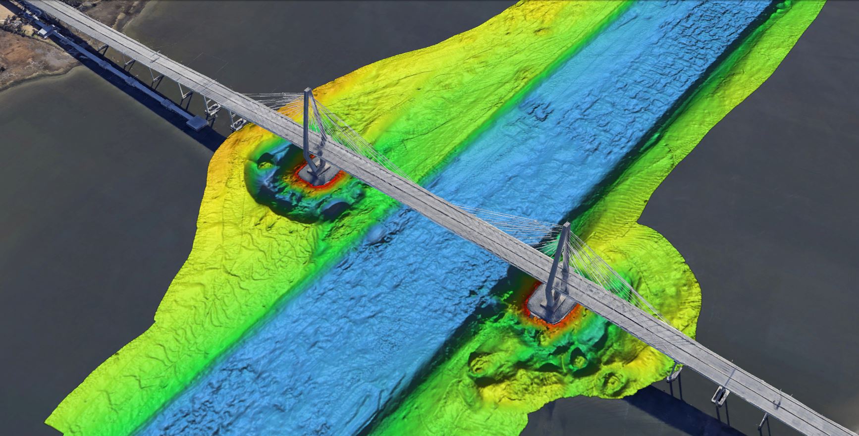
A colorized rendering of Arthur Ravenel Jr. Bridge, Charleston, South Carolina
image by Edgetech
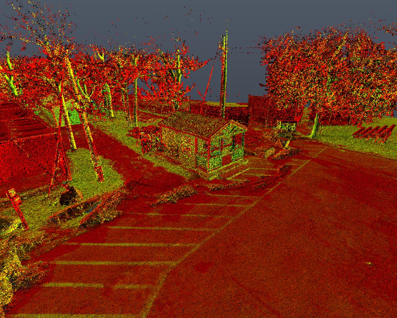
Close Range handheld LiDAR point cloud of picnic tables in pine grove Harbor Park, Northeast Harbor, Nov. 2023
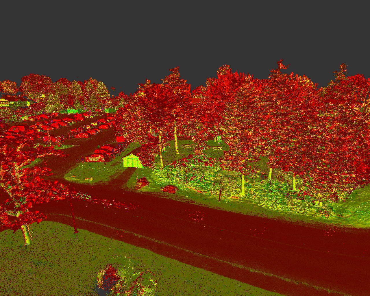
Close Range handheld LiDAR point cloud Little League Complex The Ballfields, Bar Harbor, Feb. 2024
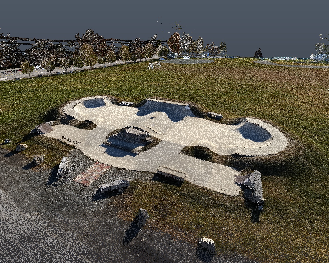
Close Range drone LiDAR RGB point cloud of Skate Park and Helipad Area East Ballfield, Bar Harbor, Nov. 2023

Place Location
We can assist you on your next land related project whether you are a private landowner, architect, construction contractor, municipality, or a boat builder/designer.
LANDOWNERS AND ARCHITECTS
- • Boundary Surveys
- • Legal Descriptions of Real Estate property
- • Zoning Setback Staking• Planning Board Site Plans
- • Maine DEP Permitting Site Plans
- • Mortgage Inspections
- • FEMA Flood Certificates and Letters of Map Amendments
- • Tree Growth/Open Space Mapping
- • Celestial Event Building Orientation
- • Laser Scanning of Architectural Details in CAD
CONTRACTORS AND DEVELOPERS
- • Subdivisions
- • Planning Board Site Plans
- • Subsurface Utility Mapping
- • Detailed Topographic Site Plans
- • Road Profiles and Alignments
- • Building Volume Calculation
- • Construction Material Volume Calculation
- • Site layout for Residential, Commercial, and Industrial Projects
- • Concrete layout simple and complex up to 1/16" accuracy
GOVERNMENTAL AGENCIES
- • Road Right of Ways
- • Harbor Mooring Swing Radius Mapping
- • Hydrographic Surveys
- • Archaeological surveys
- • Monitoring Well Mapping
- • Municipal Mapping for GIS development
- • Subsurface Utility Mapping
- • Detailed Topographic Contoured Site Plans
- • Road Profiles and Alignments
- • Construction Material Volume Calculation
BOAT BUILDERS/DESIGNERS
- • Laser Scanning of Boat Hull Prototype Contours